• -€10.10
  • Detailed map of major French lakes - N°1 - comptoirnautique.com
  • Detailed map of major French lakes - N°2 - comptoirnautique.com
  • Detailed map of major French lakes - N°3 - comptoirnautique.com
  • Detailed map of major French lakes - N°4 - comptoirnautique.com
  • Detailed map of major French lakes - N°5 - comptoirnautique.com
  • Detailed map of major French lakes - N°6 - comptoirnautique.com
  • Detailed map of major French lakes - N°7 - comptoirnautique.com
  • Detailed map of major French lakes - N°8 - comptoirnautique.com
  • Detailed map of major French lakes - N°9 - comptoirnautique.com
  • Detailed map of major French lakes - N°10 - comptoirnautique.com

Detailed map of major French lakes

Ref. HB-LAKE-M

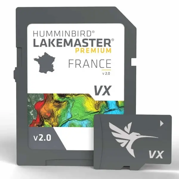
The LakeMaster® France map from Humminbird® offers highly accurate cartographic coverage of the main French lakes: Salagou (aerial view) / Orient (aerial view) / Hourtin / Lacanau / Sanguinet / Biscarosse / Pareloup(aerial view) / Esparon (aerial view) / Serre-ponçon (aerial view) / Grangent (aerial view) / Villerest(aerial view) / Bourget / Leman / Vouglans (aerial view) / Plobsheim (aerial view) / Vassiviere (aerial view)

The lake drop-down list lets you view and search for lakes from your handset Humminbird on and off the water.

LakeMaster maps are compatible with all HELIX G3 and G4, APEX & SOLIX series models.

Access a wealth of navigation data: navigation aids, artificial reefs and points of interest.

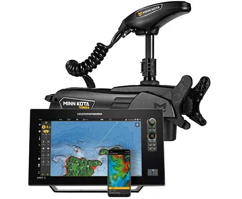
ONE-BOAT NETWORK: Your i-Pilot Link engine, your Humminbird handset and your LakeMaster chart are now interconnected. This allows you to automatically follow every bathymetric contour line and gives you precise control of your boat's anchoring and drifting.

Read more Features
€228.90 Tax included
Public price
€239.00
Price tax excl. / DOM TOM €190.75
Quantity
OUT OF STOCK
By buying this product you can collect up to 228 loyalty points. Your cart will total 228 points that can be converted into a voucher of €2.28.
HB-LAKE-M

Data sheet

Product type
Cartography
Description

HUMMINBIRD - LAKE MASTER PREMIUM - EVEN MORE DETAIL

From easy-to-read contours to highlighted depth ranges, the LakeMaster map offers all the tools you need to find the best fishing spots and navigate them safely.

Access a wealth of navigation data: navigation aids, artificial reefs and points of interest on France's main lakes: Salagou (aerial view) / Orient (aerial view) / Hourtin / Lacanau / Sanguinet / Biscarosse / Pareloup(aerial view) / Esparon (aerial view) / Serre-ponçon (aerial view) / Grangent (aerial view) / Villerest(aerial view) / Bourget / Leman / Vouglans (aerial view) / Plobsheim (aerial view) / Vassiviere (aerial view)


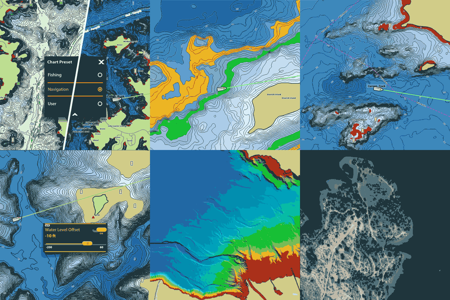
Différentes vues et caractéristiques de la carte Lake Master Humminbird

DETAILED CARTOGRAPHY

The French lake map by Humminbird is a comprehensive tool which, with predictive software on your multifunction display, enables you to navigate safely and plan your day's fishing.

  • SmartStrike : enter search parameters such as season, time of day, temperature and target fish species, to highlight areas of the map where fish are most likely to bite.
  • VX Vector map display : precise contours and customizable color palettes to help you find popular fishing spots faster.
  • Shallow water highlighting: red shading highlights areas of shallow water over an adjustable range from 0 to 60 feet.
  • Water level offset : synchronizes depth contours with actual water levels in lakes, reservoirs and rivers.
  • 2D shaded relief : quickly identify fish holding areas with 2D shaded relief, making it easy to spot bottom details and depth changes.
  • Aerial imagery : navigate with confidence and find new fishing grounds thanks to aerial imagery layers.


ONE-BOAT NETWORK

Your i-Pilot Link engine, your Humminbird handset and your LakeMaster chart are now interconnected.

Automatically follow every bathymetric contour line and get precise control of your boat's anchoring and drifting.

Compatible with Humminbird HELIX G3 / G3N / G4N and newer, all SOLIX units and all APEX units .

HB-Lake-M - Carte Lake Master Humminbird connectivité One Boat Netword

MAIN POINTS :

  • Shaded relief
  • On-board network
  • Aerial imagery
  • Depth range
  • VX vector mapping
  • Covers most French lakes

BOX CONTENTS :

  • 1 - LakeMaster France memory card
  • 1 - PDF documentation


Customer Reviews (0)

Questions / Answers

Back to top
Cart
Your cart is empty