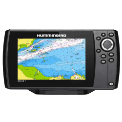
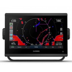
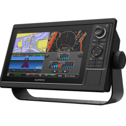
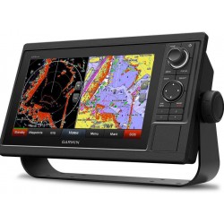
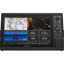
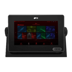
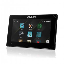
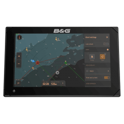
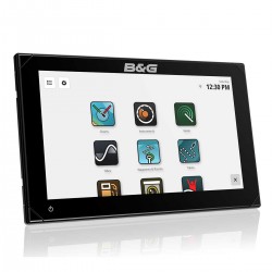
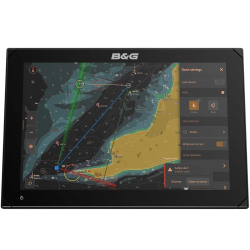
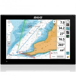
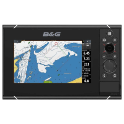
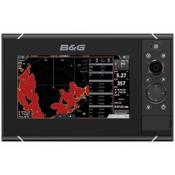
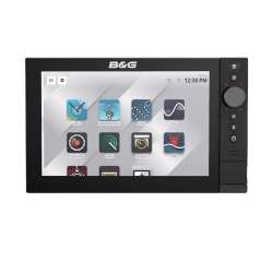
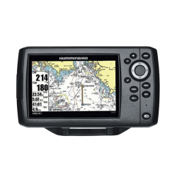
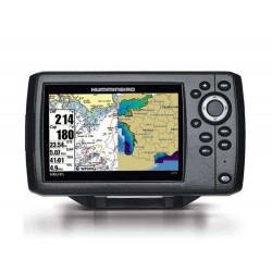
Gps chartplotter

Navigate safely with our boat chartplotters. Simple, intuitive and robust, our chartplotters allow you to create waypoints, manage autopilots... These multi-function color displays are highly upgradeable. You can connect your radar, thermal camera, AIS, GPS sounder and much more. Compatible with navigation charts, Navionics, Garmin or C-Map navigation maps, depending on your device model.

Discover our range of GPS chartplotters and multifunction displays or sounder combos at the best prices, with 24h to 48h delivery for products in stock
You can choose between screen size, screen type, device compatibility and NMEA compatibility.
Find the best ranges from each brand: Garmin EchoMAP and GPSMAP 1223 for example, Humminbird Helix, B&G Vulcan and Zeus and Raymarine Axiom ...

EchoMAP 72
⭐️ Best Seller

€849.90 €949.00 -10%
Last items in stock
  • -€99.10
EchoMAP 92
⭐️ Best Seller

€975.90 €1,159.00 -15%
Last items in stock
  • -€183.10

€639.90 €756.00 -15%
En stock
  • -€116.10

€915.90 €1,080.00 -15%
En stock
  • -€164.10
GPSMAP 723
⭐️ Best Seller

€899.90 €1,049.00 -14%
  • -€149.10

€1,199.90 €1,579.00 -24%
  • -€379.10

€1,689.90 €1,889.00 -10%
IN SUPPLIER STOCK
  • -€199.10

€2,429.90 €2,729.00 -10%
IN SUPPLIER STOCK
  • -€299.10

€1,899.90 €3,049.00 -37%
  • -€1,149.10

€899.90 €1,008.00 -10%
Last items in stock
  • -€108.10

€1,529.90 €1,716.00 -10%
Last items in stock
  • -€186.10

€2,699.90 €3,024.00 -10%
IN SUPPLIER STOCK
  • -€324.10

€1,729.90 €1,934.00 -10%
IN SUPPLIER STOCK
  • -€204.10
Slide thumbnail
Slide thumbnail
Slide thumbnail

gamme GPS traceur de carte

THE GPS CHARTPLOTTER: A MUST-HAVE AT SEA

Do you want to conquer the sea and are looking for the best way to sail with peace of mind? Equipping your boat with a GPS chartplotter is the most effective way of tackling the waves .

Waterproof and, for the most part, with a touch screen that doesn't consume a lot of power, these marine jewels will give you a great deal of security, especially if you're discovering new places. Able to notify you of the presence of a simple buoy, you can navigate without fear of encountering obstacles.

A real dashboard, the GPS marine chartplotter positions the boat on the chart and notifies you of elements on the way. Depending on the model, you'll be able to locate yourself, mark positions,be informed of tides, currents, routes and even the time of your arrival.

Whether you own a large sailboat or a fishing boat, you'll find among our selections the leading brands offering chartplotters such as GARMIN, RAYMARINE, HUMMINBIRD, B&GsIMRAD and FURUNO. And our accessories: bracket, cover, cable, external GPS antenna, etc.

Usually called chartplotter, GPS boat or GPS marine chartplotter, we also find terms like Plotter or Chartplotter. But it's all the same electronic boat GPS with color display.

Don't miss our 3" to 5" handheld GPS units like the GPSMAP 276Cx, NMEA-compatible GPSMAP 79s or GPS 73 positioner.

A GPS chartplotter is now indispensable for all your navigation needs, whether you're on a sailboat or a motorboat. Given the vast choice of marine chartplotters on the market, here are the questions you need to ask yourself before buying.


Choisir son gps traceur de carte

How to choose a boat GPS plotter?

A boat GPS plotter is much more than a basic marine GPS. Depending on the model you choose, you can upgrade it with additional peripherals:

  • AIS boat: connect a AIS receiver or a AIS transponder to view nearby equipped boats.
  • Marine radar: In fog or when sailing at night, view all ships and coastlines, and navigate around storms.
  • Navigation instruments: Depending on GPS plotter compatibility, you can display loch speedo, depth sounder, wind vane, engine info, compass..

And for the more demanding users who opt for a multifunction display, you can add radar or a depth finder to your GPS plotter. And enjoy all the functions of this type of device, whether for fishing or navigation.


Fonction d'un lecteur de carte marine

What are the functions of a GPS chartplotter?

The primary function of a GPS plotter is to locate your boat in real time, thanks to thebuilt-in GPS antenna. By adding a GPS marine chart Navionics, Garmin or C-Map, depending on compatibility with your screen (see our cartography category), you'll obtain details of your navigation zone.

A chartplotter can be touchscreen, mixed (touchscreen with keys) or simply a physical button

Memorize and quickly find your favorite places or fishing spots by placing individual waypoints on your marine GPS.

Plan your navigations by simply programming your routes: place different waypoints according to your itinerary, and the GPS chartplotter will link them up via theGPS antenna.

Be sure to choose the right chart for your GPS boat from among the following: Navionics Huminbird, Lowrance, Raymarine. Navionics Vision Garmin, C-map Lowrance , Simrad, B&G...

Now you're ready to navigate.

Some chart readers automatically create your route, taking into account your boat's parameters: draught, air draught, etc

Back to top
Cart
Your cart is empty