- -€20.08
Navionics + charts are designed for sea or inland waters. This all-in-one solution offers richly detailed integrated cartography, isobaths every 50 cm, and advanced functions such as automatic Autorouting Dock-to-Dock route creation.
Navionics also offers access to daily updates via the Navionics Chart Installer software for 12 months (renewable after 12 months via subscription)
NB: Navionics + charts are not compatible with Garmin chartplotters, please refer to the chartplotter compatibility guide.
Read more FeaturesData sheet
- Range
- Navionics +
- Card size
- Large (L), Regular (R)
- Geographical area
- Asia
- Product type
- Cartography
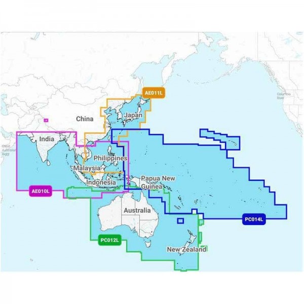
NAVIONICS - NAVIONICS+ LARGE CARTOGRAPHY - ASIA AND PACIFIC REGION
On the water, it's essential to know your route and have charts you can rely on. Seamlessly combining marine and lake chart content, this all-in-one solution offers clear, reliable mapping for the widest range of chartplotter brands.
Navionics + maps are available on micro SD/SD memory cards for easy installation on your compatible marine device.
Choose from the different regions available in LARGE format for Asia and the Pacific | East Asia in the Navionics+ range . Download the region code guide below.
|
|
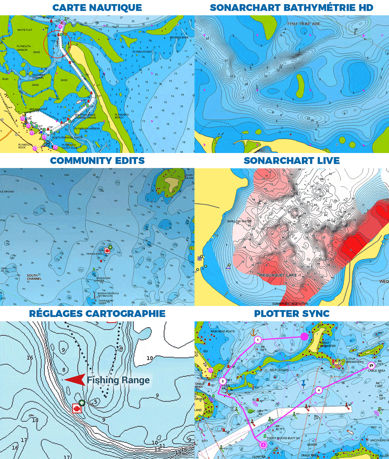
NAVIONICS+ MAP FEATURES
|
HOW TO CHOOSE YOUR NAVIONICS CARD?
| NAVIONICS+ | PLATINUM+ | |
|---|---|---|
| Nautical Chart | ✅ | ✅ |
| SonarChart | ✅ | ✅ |
| Community Edits | ✅ | ✅ |
| Unlimited updates | ✅ | ✅ |
| Autorouting Dock-to-dock | ✅ | ✅ |
| SonarChart Live | ✅ | ✅ |
| Cartography settings | ✅ | ✅ |
| Plotter Sync | ✅ | ✅ |
| Satellite overlay with SonarChart Shading | ❌ | ✅ |
| 3D view | ❌ | ✅ |
| Panoramic photos | ❌ | ✅ |
MAIN POINTS :
|
BOX CONTENTS :
|
Accessories
Customer Reviews (0)
Questions / Answers


