- -€25.08


Platinium+ REGULAR card - AMERICAS zone
Ref.
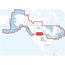
N-NPUS004R
Navionics Platinum+ charts are designed for the most demanding boaters and fishermen. Platinum+ content is enhanced with additional visualization options that contribute to the ultimate marine navigation experience.
Platinum+ charts combine superior marine content for oceans, major rivers and seas with inland water mapping covering over 42,000 lakes worldwide.
Navionics also offers access to daily updates via the Navionics Chart Installer software for 12 months with the purchase of a chart (renewable after 12 months via subscription)
NB: Platinium+ charts are not compatible with Garmin chartplotters, please refer to the chartplotter compatibility guide.
N-NPUS004R
Data sheet
- Range
- Platinium +
- Card size
- Regular (R)
- Geographical area
- America
- Product type
- Cartography
NAVIONICS - CARTOGRAPHY PLATINIUM+ REGULAR - GEOGRAPHIC AREA AMERICAS
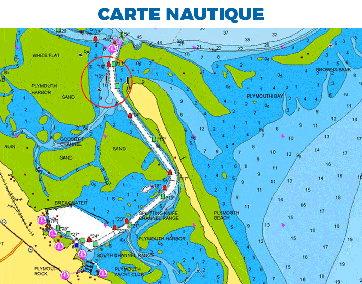
On the water, it's essential to know your route and have maps you can rely on. Seamlessly combining marine and lake chart content, this all-in-one solution offers clear, reliable mapping for the widest range of chartplotter brands.
Platinum+ charts are available on micro SD/SD memory cards for easy installation on your compatible marine device.
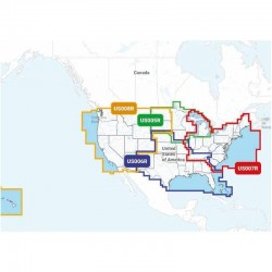
Choose from the different regions available in REGULAR format for the Americas in the Platinum+ range . Download the region code guide below.
|
|
PLATINIUM+ CARD FEATURES
|
PLATINIUM+ & NAVIONICS+ FEATURES
|
|
HOW TO CHOOSE YOUR NAVIONICS CARD?
| NAVIONICS+ | PLATINUM+ | |
|---|---|---|
| Nautical Chart | ✅ | ✅ |
| SonarChart | ✅ | ✅ |
| Community Edits | ✅ | ✅ |
| Unlimited updates | ✅ | ✅ |
| Autorouting Dock-to-dock | ✅ | ✅ |
| SonarChart Live | ✅ | ✅ |
| Cartography settings | ✅ | ✅ |
| Plotter Sync | ✅ | ✅ |
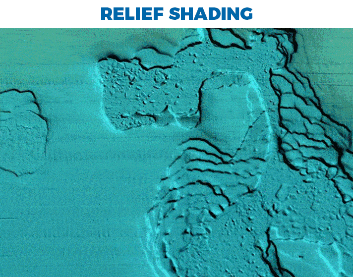
| Satellite overlay with SonarChart Shading | ❌ | ✅ |
| 3D view | ❌ | ✅ |
| Panoramic photos | ❌ | ✅ |
MAIN POINTS :
|
BOX CONTENTS :
|
Accessories
Customer Reviews (0)
No customer reviews for the moment.
Sign in to leave a review
Questions / Answers
