- -€266.75


☀️ PROMO SUMMER


The TZMAP13 is designed for boaters who want safer navigation and more efficient fishing. Featuring TZ MAPS mapping, a TruEcho CHIRP echo sounder, CHIRP Side-Scan technology and radar compatibility, it offers reliable functionality in a compact package.
With the TZMAP 13, optimize every outing on the water to explore further and longer.
Data sheet
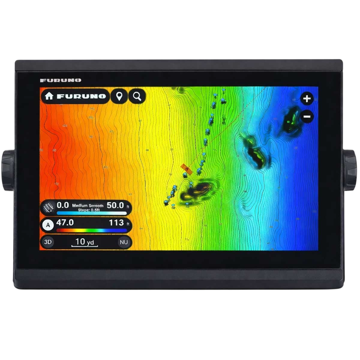
The TZMAP13 is a self-contained 13" fishfinder chartplotter, designed for compact boats, fishing boats or semi-rigid boats. Its sunlight-readable Multi-Touch color screen puts TZ MAPS cartography at the forefront, with advanced functions such as AI Routing and BathyVision.
On the sounder side, you benefit from an integrated CHIRP or CW sounder, with Side-Scan for side scanning. It's all easy to use, and connects via Wi-Fi for TZ MAPS maps, TZ Weather and TimeZero ecosystem functions.
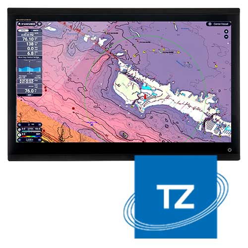 |
TZ MAPS mappingWith TZ MAPS cartography, you can prepare your navigations faster and with greater peace of mind. Charts are supported by official hydrographic data, bathymetric information and easy-to-read display options to keep you focused on the road ahead.
Whether you're anchoring or fishing, you can adjust the display in just a few gestures and always have the information you need right at hand. |
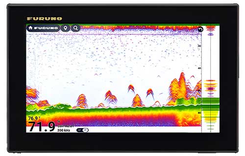
Integrated sounder CHIRPThe TZMAP13 is the ultimate ally for demanding anglers. Thanks to its built-in TruEcho CHIRP 300W, 600W or 1 kW sounder, it offers powerful and accurate deep-water detection, ideal for tracking big catches. Its integrated Side-Scan CHIRP 230/455 kHz scans both port and starboard sides in high resolution, revealing fish and submerged structures in impressive detail.
|
 |
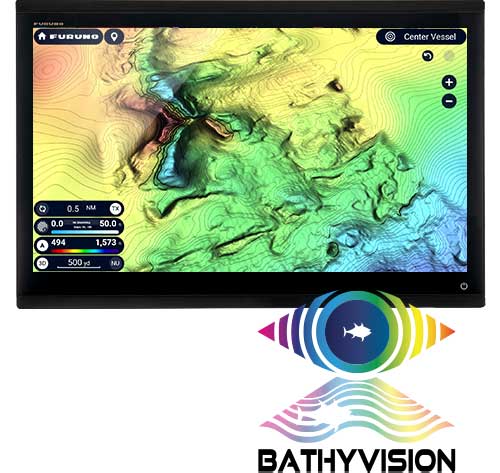 |
BATHYVISION & AI ROUTINGThe TZMAP13 takes marine cartography to the next level with BathyVision and TZ Maps. It provides access to very high-resolution bathymetry, with adjustable depth curves at intervals of up to 7 cm - a level of accuracy well above-traditional charts. This data is superimposed on TZ MAPS cartography to build much more detailed and exploitable fishing zones. Support for AI Routing makes route planning safer and simpler. It calculates the best route, taking into account map data, depths and hazards. |
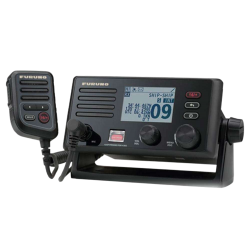
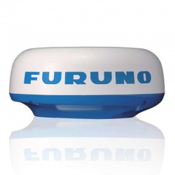
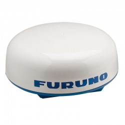
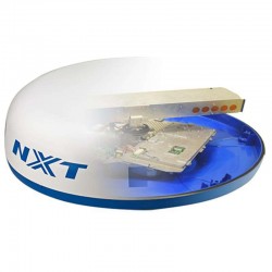
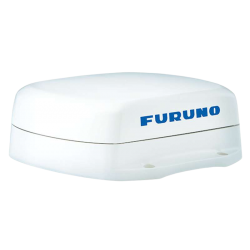
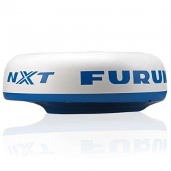
Radar, TZ Weather and Dynamic MooringNo matter which radar model you choose: the Magnetron X-Class, or the Doppler NXT for example, you'll benefit from clear images and precise functions such as Target Analyzer, Fast Target Tracking, Bird Mode or Rain Mode. The TZ Weather mode provides quality weather forecasts worldwide. Its simplified Weather Timeline & Layers interface gives you the tools you need to anticipate poor conditions and the right moment to set sail. What's more, the Dynamic Mooring function crosses topography and weather to select the safest anchorages. Moorings are derived from high-definition vector maps, enhanced by TIMEZERO's "Community Maps", for a reliable, up-to-date anchorage base. |
 |
|
TZMAP13 | ||
|---|---|---|
| Screen size | 9" | 12.8" |
| Resolution |
1280 x 720 | 1920 x 1080 Full HD |
| Display type | Touchscreen | |
| Integrated depth sounder | CHIRP 1kW + SideScan | |
| Integrated GPS | ✔️ | |
| Installation type | In-wall / Stirrup | In-ceiling / Bracket |
| Dimensions (WxHxD - flush-mount) | 241.5 x 155.5 x 87.4 mm | 334 x 224 x 93.4 mm |
| Weight | 1.9 kg | 3.2 kg |
MAIN FEATURES :
|
BOX CONTENTS :
|
Accessories
Customer Reviews (0)
Questions / Answers