- -€333.42


☀️ PROMO SUMMER


The NavNet TZtouch 13E combines a 9" multi-touch HD multifunction display with advanced TZ MAPS cartography, Bathyvision bathymetry or TruEcho CHIRP 1 kW echo sounder and Side-Scan.
The TZT13E gives you exactly what you need for navigation and fishing, as well as onboard radar, AIS or sounder compatibility.
Data sheet
The TZT13E is a 13-inch Furuno multifunction display, designed to build a modern, readable and responsive navigation center. It combines GPS plotter, advanced cartography, navigation functions, radar and sensor integration in a compact format that easily fits in the cockpit.
With TZ MAPS cartography, you can customize the display and useful layers, including bathymetric data, for greater precision when cruising or fishing. The TZT13E also incorporates a TruEcho sounder CHIRP and supports Side-Scan CHIRP, with network connectivity designed to upgrade your installation over time.
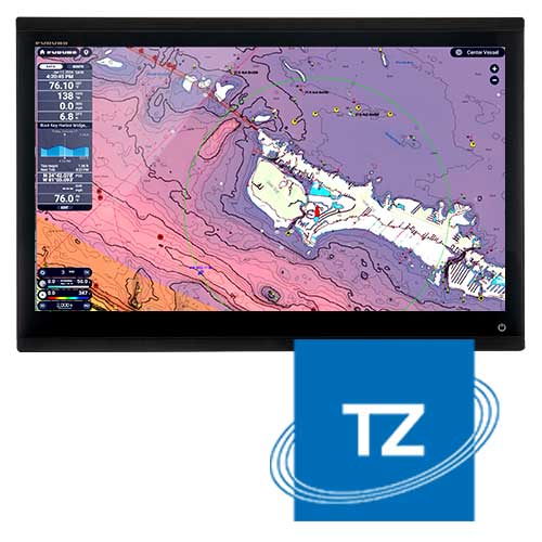 |
TZ MAPS mappingThe TZT13E features TZ MAPS cartography for easy map reading and customization. You can adapt the display to your program, whether you're cruising inshore, offshore, or searching for fishing grounds.
A sharper, easier-to-interpret map, with useful information displayed at the right moment on your multifunction display. |
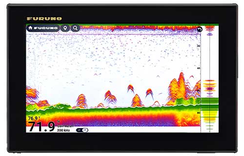
Integrated sounder CHIRPThe TZT13E is ready for serious fishing. It features an internal TruEcho sounder CHIRP or CW, and a Side-Scan CHIRP 230 kHz/455 kHz. You get a cleaner reading, better target separation, and ideal lateral vision for spotting structures and breaks.
In practice, you can locate an area of interest more quickly, then track activity accurately, even when fish are flattened to the bottom or close to structure. |
 |
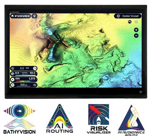 |
BATHYVISION & AI ROUTINGThe TZT13E takes marine mapping to the next level with BathyVision from TZ Maps. For greater comfort and safety, the TZT13E unlocks advanced navigation tools linked to TZ MAPS cartography. BathyVision highlights bathymetry, while AI functions help you build a smoother route, especially in complex or busy areas.
You retain control over your decision, while benefiting from a display that makes risks more visible. AI Routing requires a valid TZ MAPS subscription for your zone. |
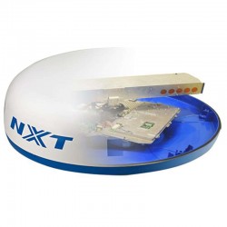
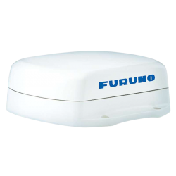
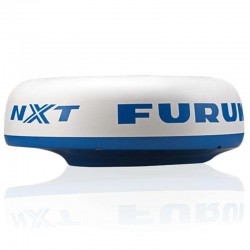
Radar, TZ Weather and Dynamic MooringNo matter which radar model you choose: the Magnetron X-Class, or the Doppler NXT for example, you'll benefit from clear images and precise functions such as Target Analyzer, Fast Target Tracking, Bird Mode or Rain Mode. The TZ Weather mode provides quality weather forecasts worldwide. Its simplified Weather Timeline & Layers interface gives you the tools you need to anticipate poor conditions and the right moment to set sail. What's more, the Dynamic Mooring function crosses topography and weather to select the safest anchorages. Moorings are derived from high-definition vector maps, enhanced by TIMEZERO's "Community Maps", for a reliable, up-to-date anchorage base. |
 |
|
TZT13E | ||
|---|---|---|
| Screen size | 9" | 12.8" |
| Resolution |
1280 x 720 | 1920 x 1080 Full HD |
| Display type | Touchscreen | |
| Integrated depth sounder | CHIRP 1kW + SideScan | |
| Integrated GPS | ✔️ | |
| Installation type | In-wall / Stirrup | In-ceiling / Bracket |
| Dimensions (WxHxD - flush-mount) | 241.5 x 155.5 x 87.4 mm | 334 x 224 x 93.4 mm |
| Weight | 1.9 kg | 3.2 kg |
MAIN FEATURES :
|
BOX CONTENTS :
|
Accessories
Customer Reviews (0)
Questions / Answers