- -€3.72


SHOM folded nautical chart - Atlantic - West coast of France
Ref.
1036990
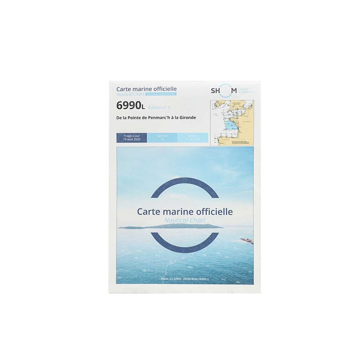
This SHOM marine chart is intended for navigation in the Atlantic on the West Coast of France. It focuses on navigation zone 6990L: From the Pointe de Penmarc'h to the Gironde.
SHOM paper charts comply with SOLAS regulations.
- Chart folded to A4 format: 21 x 29.7 cm / unfolded to A0 format: 84 x 119 cm
- Sector / Cruising Area: 6990L - From the Pointe de Penmarc'h to the Gironde
- Scale: 1:350,000
- Unit of measurement: meter
1036990
Data sheet
- Product type
- Carte de navigation
SHOM - Folded nautical chart SHOM - Atlantique - West coast of France
Designed for yachtsmen and professional sailors, the paper folded nautical charts produced by SHOM (Service hydrographique et océanographique de la Marine) provide essential information for maritime navigation.
As well as being resistant to the damp environment, the special paper allows you to write down personal navigation data (plot point, course, etc.).
 |
SHOM marine chartsSHOM paper charts generally include the following elements:
Charts are regularly updated to reflect changes in marine and coastal conditions, to keep them in line with current international standards. Comptoir Nautique also offers a selection of chart table instruments for plotting points, routes or course. |
SHOM navigation zones and chart scales
| SHOM N° | Navigation zone | Scale |
| 6990L | From Pointe de Penmarc'h to Gironde | 1 : 350 000 |
| 7068L | From Quiberon peninsula to Sables-d'Olonne | 1 : 162 000 |
| 7069L | From Ile d'Yeu to Pointe de la Coubre - Plateau de Rochebonne | 1 : 164 800 |
| 7070L | From Pertuis de Maumusson to Mimizan-Plage | 1 : 168 000 |
| 7404L | Pointe du Grouin du Cou to Pointe de Chassiron | 1 : 50 000 |
| 7405L | From La Rochelle to Pointe de La Coubre - Ile d'Oléron | 1 : 51 400 |
| 7428L | Arcachon basin | 1 : 35 000 |
Customer Reviews (0)
No customer reviews for the moment.
Sign in to leave a review
Questions / Answers (3)
How to read a nautical chart
Emmanuel, the 07/03/2025
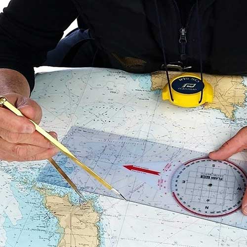
To read a nautical chart, start by identifying its scale: the larger it is, the more useful details it contains for coastal navigation. Then find the geographical coordinates, using latitude and longitude to pinpoint your exact location. Check the depths indicated in meters or feet. Observe landmarks and beacons, which serve as fixed landmarks, and look out for marked hazards, such as rocks, wrecks, sandbanks or harbor areas. Consult tide and current information to anticipate water and flow variations. Finally, to plot your course, use a navigation compass and a ruler to set a precise course, taking into account the surrounding elements.
Comptoir Nautique Team
What is-SHOM?
Laurent, the 07/03/2025
SHOM(Service hydrographique et océanographique de la Marine) is the French organization in charge of hydrography, oceanography and marine cartography. Its main mission is to guarantee the safety of maritime navigation by producing nautical charts, oceanographic forecasts and maritime geographical data.
Comptoir Nautique Team
Is a nautical chart-mandatory on board a boat?
Fabien, the 07/03/2025
A nautical chart is only compulsory when sailing between 2 and 6 miles from a shelter. In this case, you'll need the chart or charts corresponding to your navigation zone. Below that point, it is recommended but not compulsory.
Comptoir Nautique Team